CMAP Reveal M-AU-Y012-MS Cairns to Esperance
C-MAP Reveal M-AU-Y012-MS Cairns to Esperance
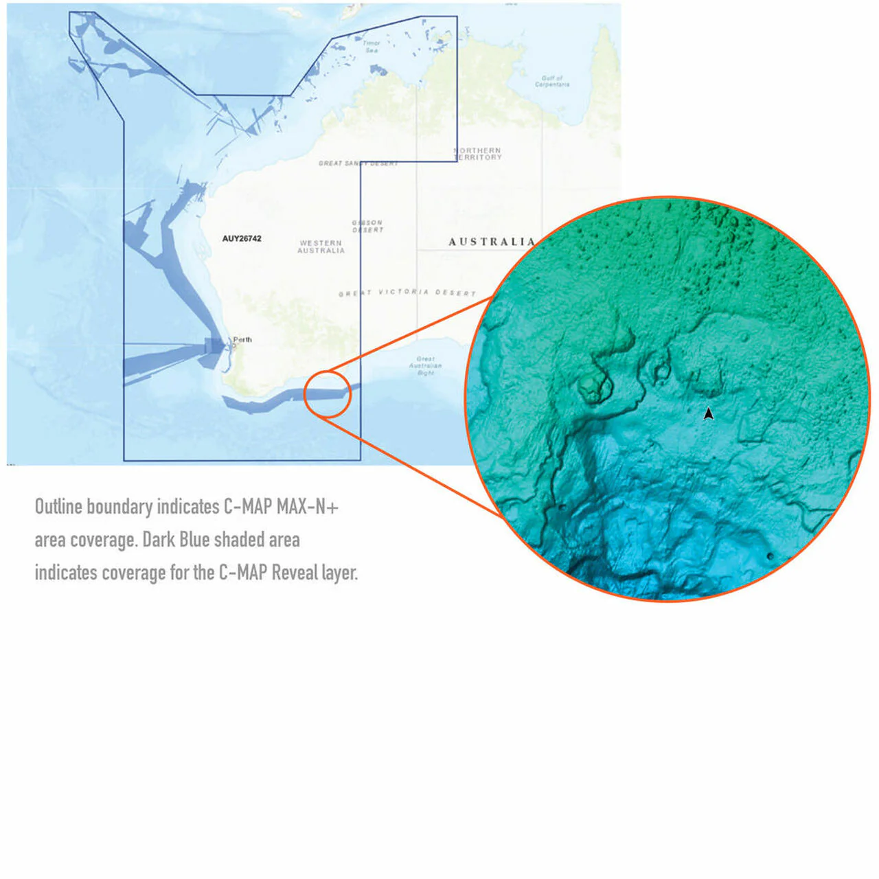
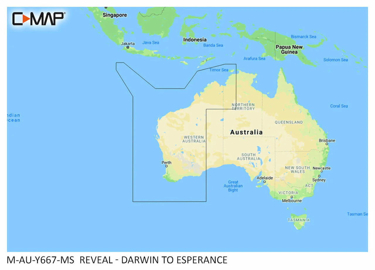
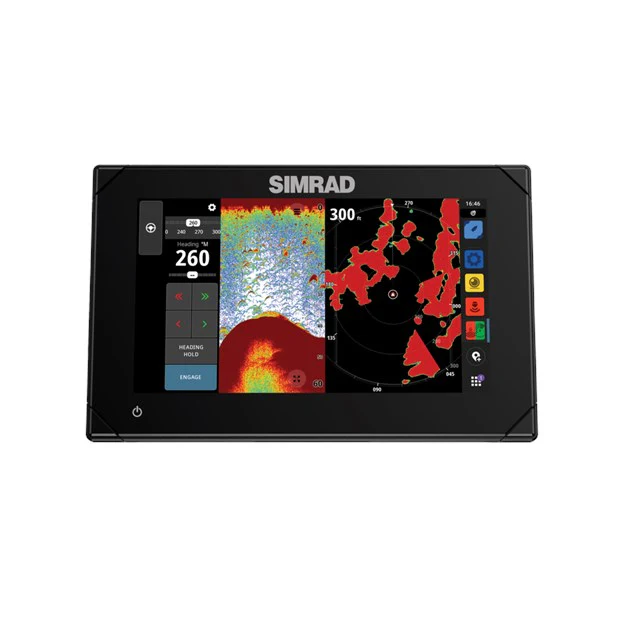
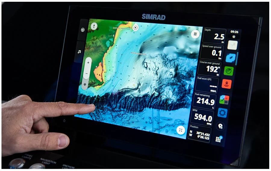
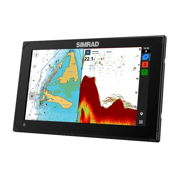
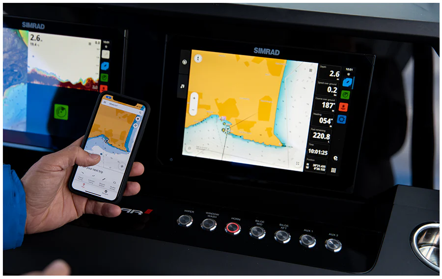
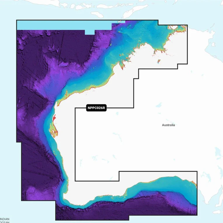
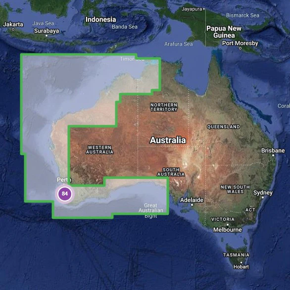
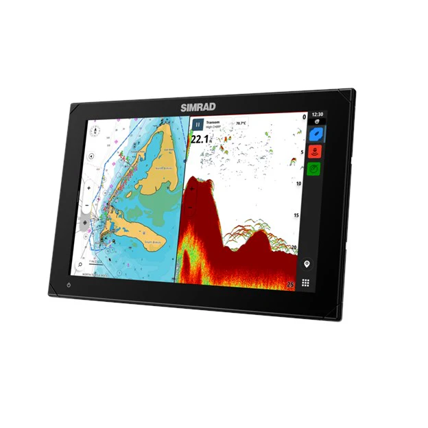
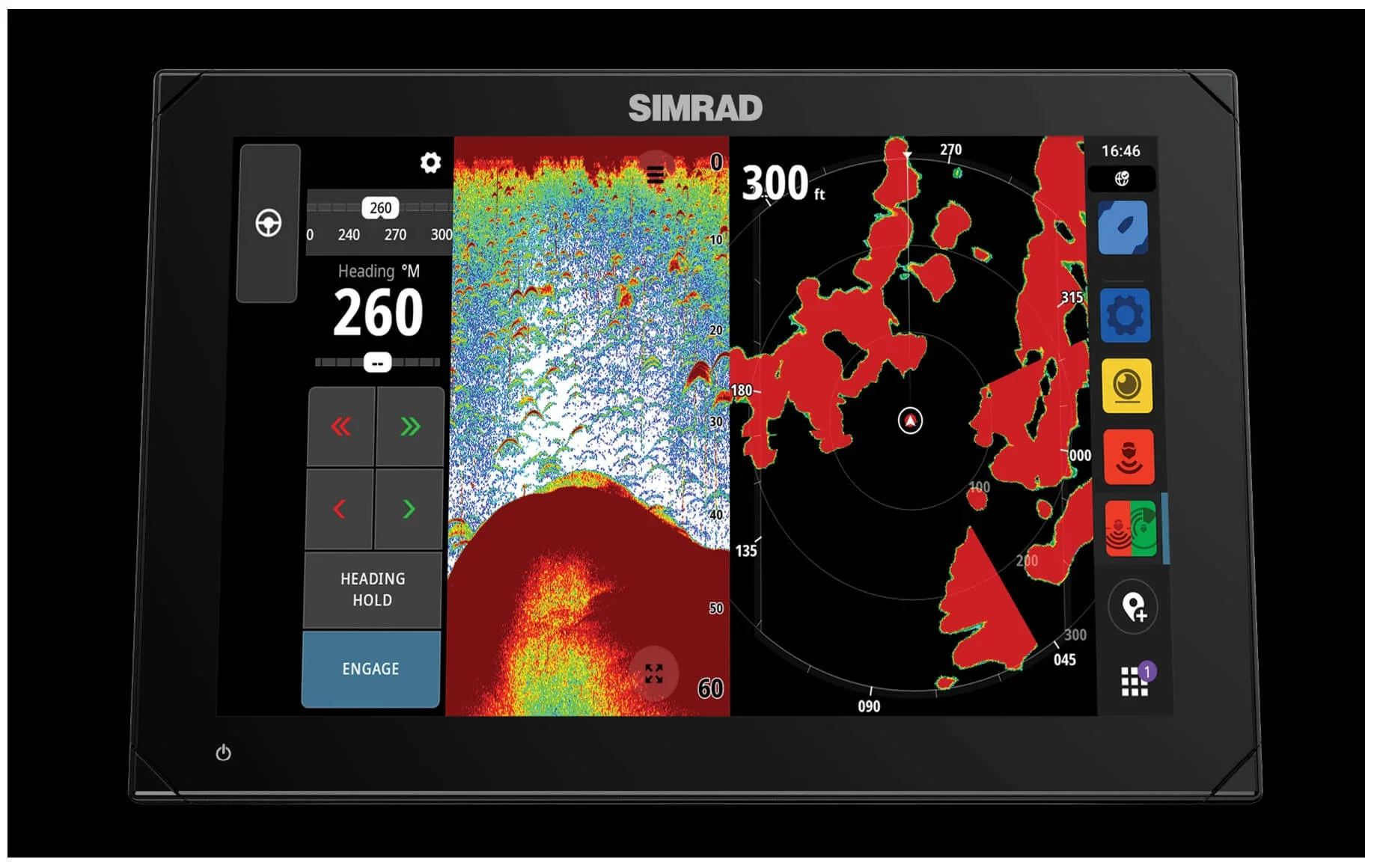
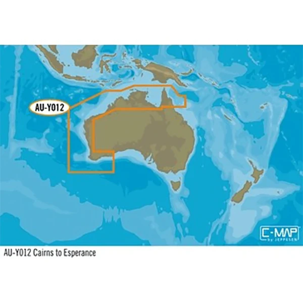
The C-MAP Reveal M-AU-Y012-MS is a premium microSD chart card covering the entire Australian coastline from Cairns right down to Esperance. Packed with ultra-high-resolution bathymetric data, shaded seafloor relief, satellite overlays, and full vector charting, this card transforms your compatible Lowrance, Simrad, or B&G chartplotter into a serious navigation and fish-finding tool.
Key Features
- Coverage from Cairns to Esperance including Victor Harbor to Wellesley Islands
- Ultra-High-Res Bathymetric seafloor imagery with integrated Genesis data
- 3D shaded relief for both land and underwater terrain
- Custom depth shading — set safety depth or create personalised colour profiles
- Easy Routing automatically plots shortest, safest route based on vessel data
- Satellite overlay, aerial photography, and detailed marina/harbour plans
- Tide and current projections for activity planning
- 12 months of free online updates included
Specifications
| Model | Coverage | Format | Compatible Brands | Updates |
|---|---|---|---|---|
| M-AU-Y012-MS | Cairns to Esperance | MicroSD | Lowrance, Simrad, B&G | 12 months free |
Target Species & Techniques
Essential for offshore anglers who rely on detailed bottom structure to locate fish-holding territory. The high-resolution bathymetry reveals drop-offs, ledges, reef edges, and sand patches that hold species like snapper, dhufish, samson fish, and coral trout. Also invaluable for safe navigation in unfamiliar waters.
C-MAP Reveal M-AU-Y012-MS Cairns to Esperance
The C-MAP Reveal M-AU-Y012-MS is a premium microSD chart card covering the entire Australian coastline from Cairns right down to Esperance. Packed with ultra-high-resolution bathymetric data, shaded seafloor relief, satellite overlays, and full vector charting, this card transforms your compatible Lowrance, Simrad, or B&G chartplotter into a serious navigation and fish-finding tool.
Key Features
- Coverage from Cairns to Esperance including Victor Harbor to Wellesley Islands
- Ultra-High-Res Bathymetric seafloor imagery with integrated Genesis data
- 3D shaded relief for both land and underwater terrain
- Custom depth shading — set safety depth or create personalised colour profiles
- Easy Routing automatically plots shortest, safest route based on vessel data
- Satellite overlay, aerial photography, and detailed marina/harbour plans
- Tide and current projections for activity planning
- 12 months of free online updates included
Specifications
| Model | Coverage | Format | Compatible Brands | Updates |
|---|---|---|---|---|
| M-AU-Y012-MS | Cairns to Esperance | MicroSD | Lowrance, Simrad, B&G | 12 months free |
Target Species & Techniques
Essential for offshore anglers who rely on detailed bottom structure to locate fish-holding territory. The high-resolution bathymetry reveals drop-offs, ledges, reef edges, and sand patches that hold species like snapper, dhufish, samson fish, and coral trout. Also invaluable for safe navigation in unfamiliar waters.
Original: $258.14
-65%$258.14
$90.35Description
C-MAP Reveal M-AU-Y012-MS Cairns to Esperance
The C-MAP Reveal M-AU-Y012-MS is a premium microSD chart card covering the entire Australian coastline from Cairns right down to Esperance. Packed with ultra-high-resolution bathymetric data, shaded seafloor relief, satellite overlays, and full vector charting, this card transforms your compatible Lowrance, Simrad, or B&G chartplotter into a serious navigation and fish-finding tool.
Key Features
- Coverage from Cairns to Esperance including Victor Harbor to Wellesley Islands
- Ultra-High-Res Bathymetric seafloor imagery with integrated Genesis data
- 3D shaded relief for both land and underwater terrain
- Custom depth shading — set safety depth or create personalised colour profiles
- Easy Routing automatically plots shortest, safest route based on vessel data
- Satellite overlay, aerial photography, and detailed marina/harbour plans
- Tide and current projections for activity planning
- 12 months of free online updates included
Specifications
| Model | Coverage | Format | Compatible Brands | Updates |
|---|---|---|---|---|
| M-AU-Y012-MS | Cairns to Esperance | MicroSD | Lowrance, Simrad, B&G | 12 months free |
Target Species & Techniques
Essential for offshore anglers who rely on detailed bottom structure to locate fish-holding territory. The high-resolution bathymetry reveals drop-offs, ledges, reef edges, and sand patches that hold species like snapper, dhufish, samson fish, and coral trout. Also invaluable for safe navigation in unfamiliar waters.